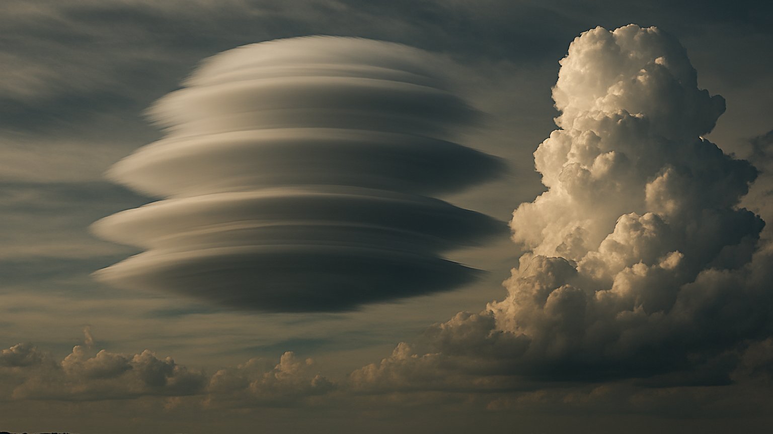
A remarkable cloud scene appeared over Schleiz in Thuringia, Germany, on November 6, 2026. Several smooth, disc-shaped clouds seemed to be stacked one above another, forming the distinctive appearance associated with layered lenticular clouds. At the same time, towering cumulus clouds rose nearby, creating a dramatic contrast between calm, organized cloud layers and much more vertically developed convection.
A stack of lenticular discs
The formation belongs to a variety of Altocumulus lenticularis called duplicatus. Lenticular clouds are often recognizable by their smooth, rounded or lens-like shapes. Unlike many clouds that drift and change rapidly, they can appear relatively fixed in the sky because they are linked to the airflow pattern over raised terrain.
In the Schleiz scene, the clouds appeared as a series of flattened, flying-saucer-like discs. Their layered structure is the feature that makes this observation especially interesting. Rather than being a single isolated lens, the formation showed multiple cloud layers arranged above one another, producing a highly photogenic pattern.
How raised terrain shapes the air
The key ingredient is stable air moving across raised terrain. When airflow is forced over elevated ground, it can generate waves in the atmosphere, much like ripples moving through water. These are commonly known as mountain waves, and they can be associated with turbulence in the air.
As the air rises within one part of a wave, it expands and cools. If enough moisture is present, condensation can create a cloud. As the air moves downward again, it warms and the cloud may evaporate. The result can be a cloud that forms and dissolves within the moving air, while remaining in approximately the same position relative to the terrain.
The duplicatus pattern develops when stable air contains alternating moist and dry layers. Each suitable moist layer can support cloud formation at a different level, while the drier layers between them help keep the discs visually separated. This produces the stacked appearance seen over Schleiz.
Stable layers beside towering cumulus
The same sky also contained towering cumulus clouds. Cumulus clouds generally grow when air rises through an unstable part of the atmosphere. Warm or buoyant air can continue ascending, allowing the cloud to build upward into a tall, bright formation.
That makes the scene a useful visual comparison. The lenticular clouds reflected the influence of stable, layered airflow over raised terrain, while the towering cumulus clouds indicated stronger vertical development in a more unstable atmospheric environment. Both cloud types can occur in the same broad weather scene because atmospheric conditions may vary considerably from one layer or location to another.
Why the formation is unusual and photogenic
Layered lenticular clouds are unusual because several atmospheric ingredients must align: raised terrain, an organized flow, stable layers, and alternating moisture conditions. Their smooth geometry also differs sharply from the billowing texture of cumulus clouds.
The result can look almost artificial, with the discs appearing carefully stacked in the sky. Yet the structure is a natural expression of atmospheric motion. The clouds are not solid objects hovering in place; they are visible regions where moisture is condensing and evaporating as air moves through the wave pattern.
The observation over Schleiz is therefore more than a striking photograph. It provides a clear example of how terrain, atmospheric stability, moisture, and vertical motion can combine to produce one of the sky’s most distinctive cloud forms.